


Voting District 20125, Kern County, California
About
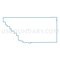
Outline

Summary
| Unique Area Identifier | 531502 |
| Name | Voting District 20125 |
| County | Kern County |
| State | California |
| Area (square miles) | 0.26 |
| Land Area (square miles) | 0.26 |
| Water Area (square miles) | 0.00 |
| % of Land Area | 100.00 |
| % of Water Area | 0.00 |
| Latitude of the Internal Point | 35.32400660 |
| Longtitude of the Internal Point | -119.01143260 |
Maps


Graphs
Select a template below for downloading or customizing gragh for Voting District 20125, Kern County, California


Neighbors
Neighoring Voting District (by Name) Neighboring Voting District on the Map
- Voting District 20135, Kern County, CA
- Voting District 20140, Kern County, CA
- Voting District 20300, Kern County, CA
- Voting District 20310, Kern County, CA
- Voting District 20490, Kern County, CA
- Voting District 20495, Kern County, CA
- Voting District 20500, Kern County, CA
- Voting District 20505, Kern County, CA
- Voting District 50030, Kern County, CA
- Voting District 50050, Kern County, CA
- Voting District 50350, Kern County, CA
Top 10 Neighboring County Subdivision (by Population) Neighboring County Subdivision on the Map
Top 10 Neighboring Place (by Population) Neighboring Place on the Map
Top 10 Neighboring Elementary School District (by Population) Neighboring Elementary School District on the Map
- Bakersfield City Elementary School District, CA (185,976)
- Greenfield Union Elementary School District, CA (49,200)